
WaveGuard for Site Acquisition
WaveGuard works to inexpensively and effectively demonstrate how antenna location and configuration fulfills Electromagnetic Field (EMF) safety requirements. WaveGuard – your most useful application in addressing EMF or “electrosmog” health issues for private and public applications.

When the antenna acquisition process requires examining and displaying radio-frequency in a graphic, easy-to-understand and highly accurate format, WaveGuard is the product you can rely on. Please contact info@wavecall-ps917soqri.live-website.com
How does WaveGuard work? Antenna manufacturers deliver the radiation pattern by means of horizontal and vertical cuts. In most cases the full 3D radiation pattern is not available. A classical method to interpolate the full 3D pattern is to add the antenna’s gain in the horizontal and vertical cuts. The comparison with field measurements has shown the two limitation of this method, especially for directive antennas that are either electrically or mechanically tilted. Based on this knowledge Wavecall implemented a new method of interpolation to best match the measurements. The improvements ranged from 4 dB in mean error and 3 dB in standard deviation. |
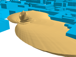
The core of the operation of WaveGuard is the 3D viewer, which visualises geographic data together with the antenna pattern in three dimensions. WaveGuard allows for interactive free flying, jumping and change of viewing and aspect. WaveGuard also fully integrates a navigation window in 2D. Movements, co-ordinates, and measurement tools are available at all times in all windows.
WaveGuard is project-oriented. Parameters and data follow the project throughout the work. Antenna data is imported, edited and exported in connection to the site data. Sites can be added and moved as well as line of sight displayed.
In the Field Diagram, the field level can be calculated in the vertical, horizontal and antenna direction, as well as in arbitrary selected planes. The result is a printable presentation with all available information in an optional scale. Coordinates are available in the window at all times.